


Autor@: Sturm, Julia
ISBN: 978-88-6648-203-1
Idioma: Inglés

Profesor/a: Casa Chinchilla @casachinchilla
Fecha: Sábado, 21 de febrero 2026
Hora: 10:30hs - 14:30hs
Duración: 4hs
Nivel: No son necesarios conocimientos previos
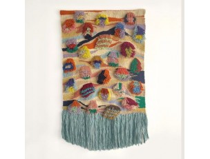
Profesor/a: Casa Chinchilla @casachinchilla
Fecha: Sábado, 21 de febrero 2026
Hora: 16hs - 20hs
Duración: 4hs
Nivel: Tienes que tener ya nociones de telar.


")


